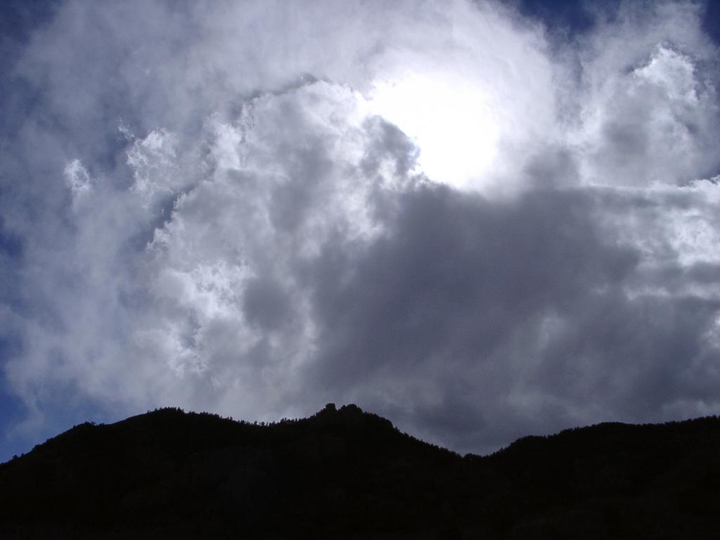
| GCMCW7 Knock-off # 15 (Paul I. area) Micro 2.0/2.5 Found-It log: March 30, 2006 by WitzAbout |
| Mr.WitzAbout (only WitzAbout) along with the 3/4krejcis. We were heading back to the parking area. I decided to peak if there were any more caches as we were taking a different route (much easier!) back. Thre was - less than 400', and it seemed like it was right along the trail - the numbers were counting down quickly! It seems Mr.krejci had the same idea - he found that we were quickly approaching this cache. We got to the area, and our 2 GPSrs were closer than they'd been all afternoon. But that still meant about a 50 foot area to search for a micro in the forest. We needed to head back, so I was emotionally prepared to give up after just a little time. I have so little luck finding micros. We were searching the area, and I moved over to a spot that was passed. I looked, and there it was! Wow - I found the micro! I think the Knock-off series will be the key to my learning to enjoy micros! This is the second one I've found without much trouble at all! It probably helped that it was missing one piece of natural camo. I put it back in place after we were done. SL. Thanks for the cache - and thanks for helping me believe in doing micros again! :) (pictures) |
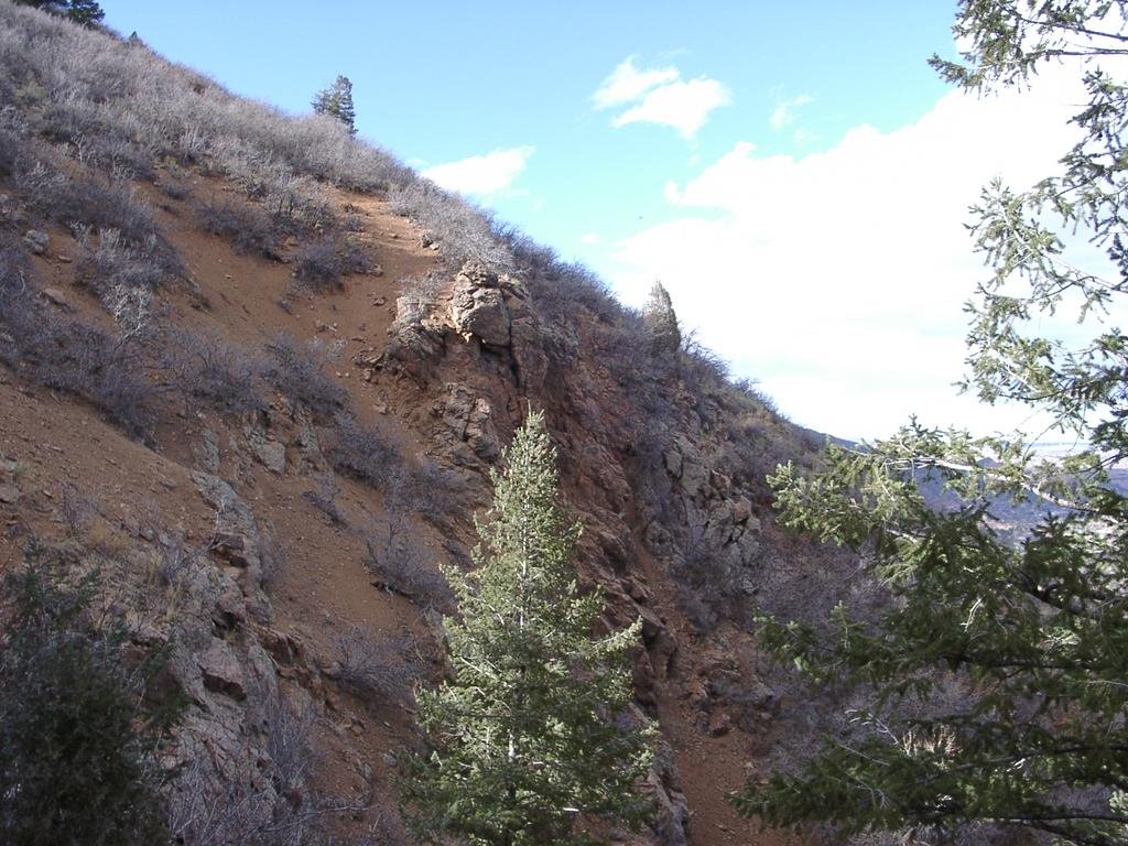 Steep Rocks on the Way  Great view of Downtown from up here 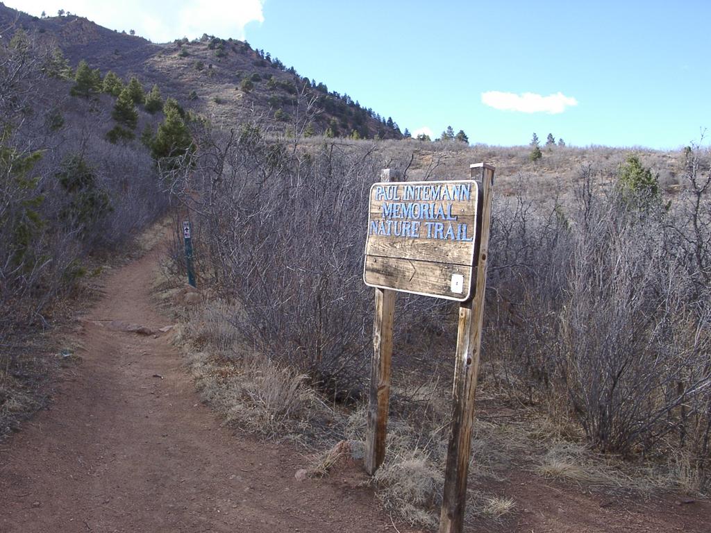 Looking back up the trail on the way out |
Thursday, March 30, 2006
GCMCW7 Knock-off # 15 (Paul I. area)
GC247F Red Rocks Ramble
For us, this was Red Rocks Scramble. We took one of the hardest ways into this cache. Trying to get to it as the crow flies. It was interesting to note, when I went back and read more of the logs for this cache, that we were not the only ones who ever came at it a harder way.
| GC247F Red Rocks Ramble Reg 1.0/2.5 Found-It log: March 30, 2006 by WitzAbout |
| Mr.WitzAbout (only WitzAbout) along with the 3/4krejcis. We took the 1.0/4.5 route in to this cache from the 'which came first cache'. Definately the hardest route in for this cache. We had some real challenges getting to this cache - brush, scrub-limbo, steep downgrades, slides that left us with red mud marks, box canyon, ice, steep crevace climb up, down again, up again through more scrub, it seemed like an hour that the GPS said we were about 300 feet away. Finally we hit a trail with less than a hundred feet away. I'm standing there, reading the detail for this cache from my palm - hoping it will help us find it. Thunk-thunk interrupts my reading. Mrs.4krejcis was tapping the cache with her walking stick. Seems they had spotted it about the time I started reading, LOL. TNLN, SL. This was a nice cache. Easy find if you go in the right way. Super challenging to get to if you take the wrong way - but we were exhilarated by the hike and glad to find the cache. And even gladder to find the main trail nearby to head back on. We were clued in to the main trail by the moutain-bikers that passed as we were doing our final ascent on this cache. Thanks for a nice hide! (pictures) |
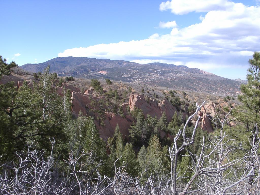 Rocks across the valley What do you mean the GPS is pointing at the rocks across the valley? 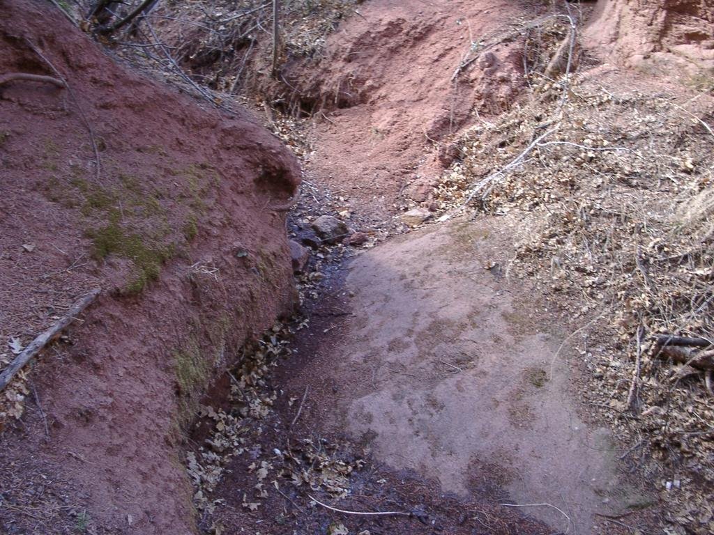 Box Canyon 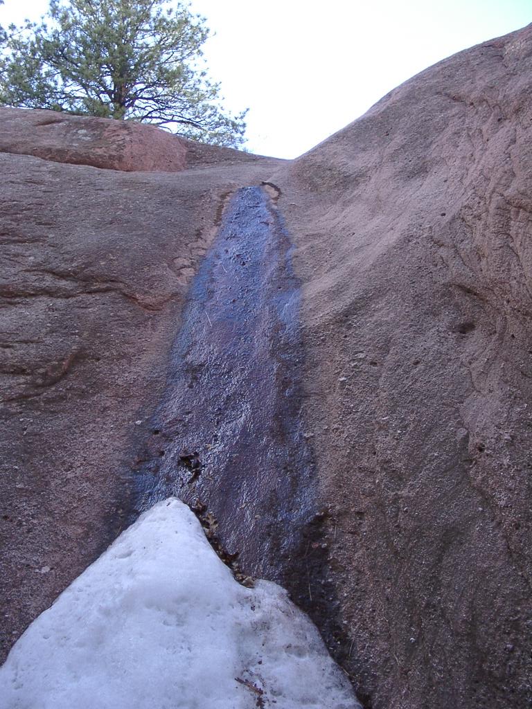 Still some ice along the stream 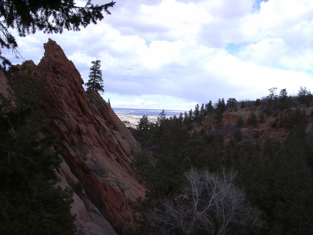 Look there's downtown Colorado Springs! 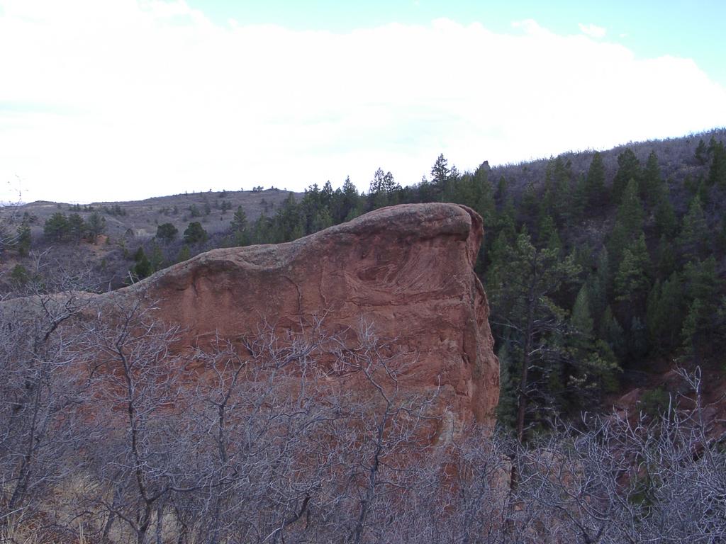 Interesting Rock Formation 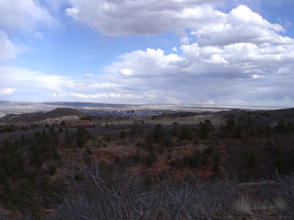 What a vista! |
GCNJAK Which came first...?
This was one of 4 for the day. I was glad to be going along with the other team for the caching - and especially for this cache. I was spending too much time looking in cracks and crevices. I've since debated the postive merits of placing a copy of this cache myself, and calling it 'Witz came first' :)
| GCNJAK Which came first...? Small 2.0/3.0 Found-It log: Mar 30, 2006 by WitzAbout |
| Mr.WitzAbout (only WitzAbout) along with 3/4krejcis. Was balancing around the rocks when Mrs.4krejcis spotted it. This was great! TNLN-SL Which came first? Taking the wrong trail. :) We doubled back and made our way in by the lower trail from the South. We then decided to do the next nearest cache - Red Rocks Ramble. Nearest if you are a crow. Going from this cache was very challenging. Do yourself a favor - stick to the main trails even if it takes you way out of the way. Great views from here. This was a neat, creative cache - fun find! (pictures) |
 Threatening Clouds It made it a bit cool for a while, but they didn't bother us otherwise 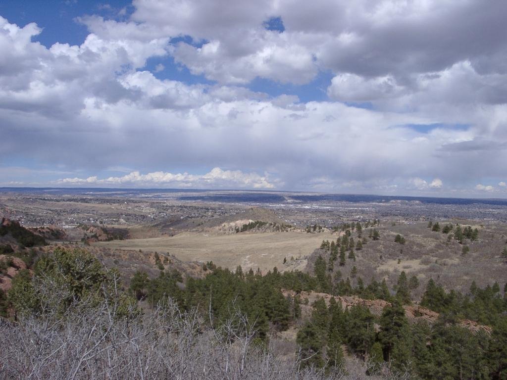 View over the meadow  Deer Watching us Watching Them |
GCC276 Away Team Mission
A premium puzzle geocache. (Premium=you have to be a paying geocaching.com member to see this cache's listing)
I'd pretty much worked this puzzle-cache out a while back. You need to triangulate from 3 radio antennas. I'd found a site online that listed the rough coordinates. They seemed too rough, so I went onto google maps, and tried to get better coordinates. I was able to zero in on 2 with a little work - especially when I noticed the shadow from the antenna masts. The clues give you bearing from these coordinates. I printed out a google map and did a rough by-eye location for the solution cache. I figured I could use google earth to tune the coordinates.
Then I put it away for a while. Last week, I was emailing with a close neighbor who geocaches - it turns out they had been working on this one too! We compared notes, and it turned out we were in the same basic area. They made to go back through their notes too to get what they figured out.
I figured I could use the line function in google earth to calculate the location. Turns out the line function in google earth does not give you bearing. So I went online and found a web page that lets you find distance and bearing for 2 coordinates. So I did trial-and-error to come up with a matching bearing with a distance past where I estimated the cache to be for each of the 3 reference locations. I was very pleased when the 3rd line crossed the same spot that the first 2 lines had crossed at. It was about 100 feet west of the coordinates the neighbors got. And mine was just in the trees, so I was feeling pretty good about the numbers.
So we decided to join forces on Sunday to find this cache. I took my 3 pirates, and they left behind their junior searchers. We detoured to get one cache along the way. It was not far off the route, and turned out to be pretty easy. I spotted what must have been the formation hiding the cache, but I let Pirate #2 confirm it and retrieve the cache. We did some trades and logged the cache. Then we were back on the trails. We were able to take a different trail from the detour towards the puzzle cache. We were at the turning point before we knew it. Pirate #3 was being a little cranky, so I wound up carrying him a little bit.
We got to the area. An area with rocky outcroppings and trees. And the hints say pine needles cover the cache. So it seemed like we were in the right spot! We searched up and down. I checked out a bunch of likely places. Then some less likely places. Then I did some more digging in needles in some likely places. Still no luck. We were also looking for a pink ribbon. We did not see that. I went up along the trail and found a weather-beaten wooden bench placed by the parks department. Not around there. I went along the ridge for part of the way. Still no go. Then I remembered that one of points was a cardinal point. 90 degrees. That meant I should be able to get to the longitude for that coordinate, and walk the line. And I did. But then I found out that the coordinates that the neighbors had were different than mine! They got them from Magellan.
So that gave us a corridor maybe 50 feet wide instead of a line. But that didn't give us the answer. We still couldn't find it. The pirates had finished their snack and were getting bored. So I did one more sweep around the ridge. No luck. We gave up. On the way back down the trail, we found another spot that we wondered if it could be right. So we spent another 10 minutes searching in this area. Finally I had to say enough for us. We left the neighbors checking one more spot.
We got down off the trail in time to just make it home to hand off Pirate #3, who had a show to go to. Or I could take them to lunch and meet the Mrs at the arena. Called on the phone, and agreed to do the lunch thing. Took the pirates to Micky-Ds or as I like to call it, the evil M-pire. And then M&Ms stole my line!
I heard from the neighbors - they got some clues from the cache owner. The copied me on the clues. I emailed some with the owner too. The neighbors decided to take Monday afternoon to try again with the hints. I could not join them. The went with their 2 junior searchers. The stayed until dark, and did not find it.
We got some more hints from the owner. I pointed out the variety of coordinates possible for the antennas, and suggested listing the source for the coordinates. Because it turns out that the coordinates he used were different than the ones I found online and the ones I calculated on the maps. I sent him maps of the different coordinates.
So it turns out the coordinates for the 90-degree was .009 less than mine. Then he said we needed to search further North. North? That would either mean that the coordinates were even further off - or they were not exactly 90-degrees.
They were not 90-degrees. I'd planned to take Thursday afternoon off from work to try again. Turns out that is exactly when the neighbors wanted to try again. So we agreed to meet at the trailhead.
I met the 3 of them there. They had along the elder Junior searcher. I cam alone. The 4 of us headed up armed with much more specific clues from the owner. Any more specific and he would have had to lead us up there by hand. :) We got to the area pretty quickly, and assaulted the location. About 5 minutes up from the trail and we were in the area. Not a minute goes by, and the ribbon is spotted. Less than another minute later, and Mr.Neighbor finds the cache! Wahoo! Yet, finding it that quickly with how much we spent looking for it before was almost a let down. Yet having done it quickly gave us time to think about more caches.
Mr.Neighbor took a reading with his GPS on the 90-degree coordinate. My GPS isn't that fancy, so I was glad he could check. When he checked, it said 91-degrees. That is quite a difference with the coordinate being probably over 2 miles away. Specifically, the final location was probably about 300 feet away from the closest we had searched on Sunday.
I had realize when I was loading coordinates for other caches in the area on Sunday that this would be my first puzzle find! Ironic since I'd put out my own puzzle cache 4 months ago. But I finally got to claim a puzzle find! I added it to my profile page that night. :)
So we wound up doing another 3 caches. The next one we started up a trail, but decided we were going the wrong way after about a half mile. So we turned back and went another way. That one worked pretty well. We only did a light bushwacking the last 100 feet. Mrs.Neighbor spotted this one. It was a cool container.
We checked our GPSs. Only 3 tenths of a mile to the next one. That is closer than the first 2. At least as the crow flies. We wound up bushwacking and playing scrub limbo following deer paths for about a half an hour. Lots of deer droppings. We even saw 2 deer at one point. Then we came to a valley. We worked our way down the valley. It got very steep towards the bottom. Bottom travel was used by most, either on purpose or due to a slide.
Then we were in a box canyon. A tiny little trickle of a stream ran through. The GPS said the cache was somewhere way up in the rocks on the other side. Without thinking about it too much, I decided to head up the stream to see if there was some way out of the box. It was really steep - I just barely managed to make it up. And all the of the neighbors were following! Okay - that works. They made it up the rocks and then we were in slightly easier terrain. But then we were going up through scrub again, and down another hill. Then we hit a trail - perpendicular to our course. We followed it a short way, then we were bushwacking uphill again. We heard, then saw some mountain-bikers to the West. Finally at the top of the hill, we were less than 100 feet from the cache!
I pulled up the listing I'd loaded on my palm. I started reading it to help us find the cache. After a couple of pages, I hear thunk-thunk. It seems Mr&Mrs.Neighbor had found it probably about the time I started reading. It was rated at the simplest level for a find. I had to laugh at myself for reading and reading when it was already found.
We did our trades, then took the main trail back towards the West, where we had seen the mountain bikers. In spite of looking like the trails weren't always going directly where we wanted to go, we doggedly stayed on the trails and followed the signs towards the trailhead parking.
As we were heading along the trail, I couldn't help but wonder if there were any other geocaches along the way. There was! Less than a 1/10 of a miles, and closing fast. It was so nice to see the distance go down so quickly after the really long time at the previous cache. It seems Mr.Neighbor had the same idea, and he had started checking about the same time I did.
It was a micro-cache. And I've developed a bit of a phobia to micros. Mostly because so many have stumped me. But we tried anyhow. The description said that enough people had a hard time with this that geocaching.com asked him to check it! Not a great sign. So I put my palm away, and joined up with the group searching. I looked down at a spot where 2 of them had just passed, and said 'is this it?'. I'd found it very quickly! I might be getting over my micro-phobia! This is the second one I've found of this type - and the other one jumped out at me too!
We signed the logs and made for the cars. It turned out we went right past the place we had turned back when we were headed for the second cache. There were still more caches in the area we wanted to do - but we needed to get back. So we will have to hit the area gain to get more of the listed caches.
A wonderful day of geocaching! Exhilarating hiking! I got some great pictures. And with geocaching friends. This was a really good afternoon!
| GCC276 Away Team Mission $ Puzzle 3.5/2.5 Found-It log: March 30 by WitzAbout |
| MrWitzAbout (only WitzAbout) - my 2nd try along with 3/4krejcis on their 3rd try. We had some hints that helped a lot. Mr.4krejcies spotted it first. Turns out I was too literal on the 90 exactly - it may help to round up. Pink ribbon is 2 very small ribbons - one 2 inches long, the other just a tiny piece tied further along the branch. I'm glad we could help the federation members transport back to the bathrooms at Palmer Park ;-) I like the Trek theme! This was a fun, yet a little frustrating cache. I'm really glad we were able to find it this time! TNLNSL - Thanks for the cache, the challenge and help! It was really nice to be able to do this with the other team. |
 Amazing View on the Way 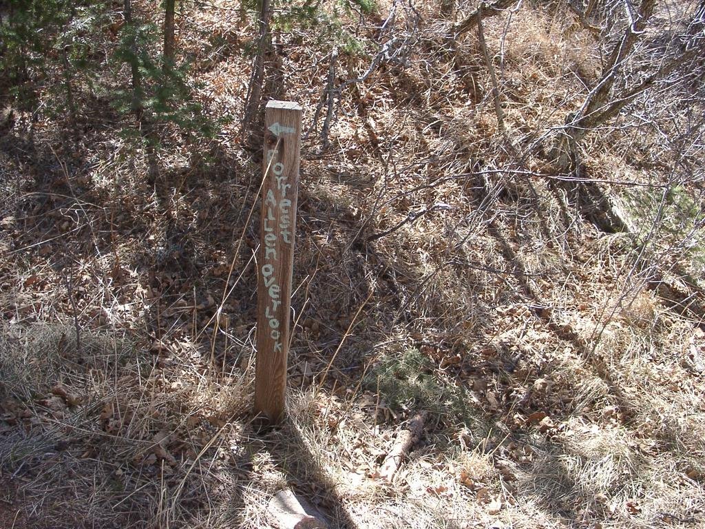 Marker Along the Trail 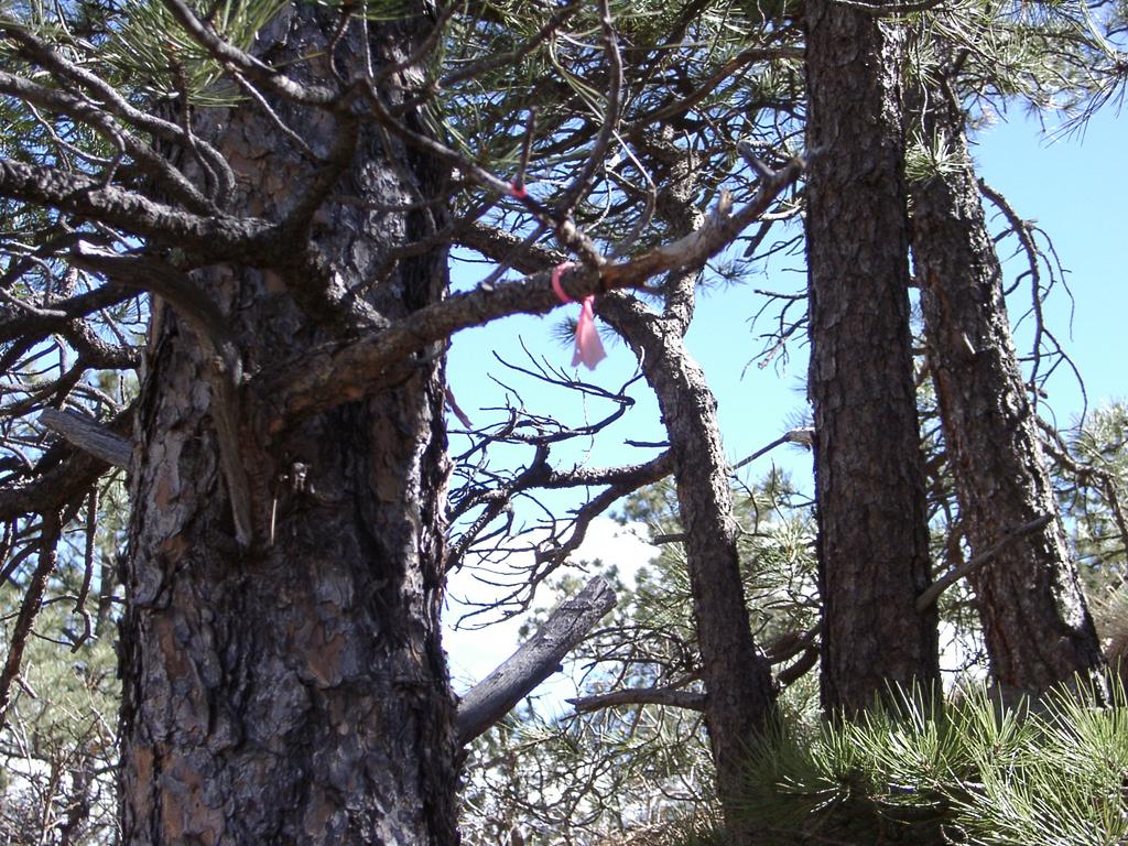 Not much left to flutter |
Tuesday, March 28, 2006
Getting to Know Geocaching
What is Geocaching?
In the simplest terms: finding things hidden by others with the GPS location or clues to the location posted on the web.
Another view of the sport: a somewhat geeky form of entertainment that gets mouse-jockeys outside for a while. Often very addictive.
How I came to geocaching:
I've always been a geek. Even when I was 7, I thought about computers before I ever saw a real one. I helped build our first computer when I was 12. I work and hobby with computers.
I used to bike all the time before I started driving. I hiked and biked a bit on rare occasion as a child and adult - and did some downhill skiing. But like most mouse-jockeys, I spend most of my time staring at a computer screen and not much time outside or exercising. I've always been heavier than 'standard'.
When I moved to Colorado in the second half of 2000, that started to change. They say it takes about 6 weeks to get acclimated to the altitude - the town is about 6,000' (about 2km high). We live at the Eastern edge of the Rocky Mountains. The town is where the high-plains meet the Rockies. There are 9,000'+ foothills at the western side of town - and at the western edge of town, a 14,115' peak mountain called Pikes Peak. The Purple Mountain Majesty in the national song.
I'm not here 2 weeks, and I'm already starting to hike around and bike a bit. I do find I run out of breath easier, but you catch your breath faster when you stop.
On my first hike, I start thinking how neat it would be to have a digital camera to take pictures along the hike. That happened less that a year later.
Since then I've been on a bunch of hikes - taking lots and lots of pictures. We would go hiking with friends - until they moved to Germany. I'd hike on my own or with others. Then 1.5 years ago, I did a bigger hike. Starting on the back side of the mountain, I hiked from 10,000' to the 14,115' summit. At one point other hikers with a GPS passed us, and were able to tell us how far we'd gotten. Neat.
At some point after that, my wife found a GPS unit in the parking lot where she worked. She turned it in, but nobody claimed it. She gave it to me. I used it a bit to track a few hikes. It was neat, but not all that exciting. A friend of ours from back in New Jersey - who moved out to California not too long before we moved to Colorado - wrote about geocaching in an email. He'd been doing more hiking with his family too. His job was working with satellites, and he was involved in sending up some of the GPS satellites, so it made sense that he would be interested in a GPS game. I didn't get it at first.
Seven months later, I was doing some training. I wanted to be able to hike up Pikes Peak again - this time from the front, starting at about 6,700' and going up to 14,115'. 7,500 vertical feet over about 13 linear miles. So I took my GPS on a bike ride up one of the foothills. I pushed until I made it past 8,000'. Then I was planning another training hike on my own. I was going up an old quarry that went up the foothills called The Scar. And I decided to check geocaching.com to see if there were any geocaches on or leading up the scar. I'd expected, as it was semi-private property, that there would not be any geocaches. I was wrong. There were a few listed, but I wasn't sure how many were on The Scar. I took 4 print-outs from the web site with me.
At that time I didn't know you could pre-load a location into the GPS and have it point out direction and distance to the point. So as I was climbing halfway up the scar, I checked the coordinates on one of the print outs. It seemed close. So I looked at the latitude and longitude on my GPS, trying to figure out which way the hidden spot was. I wound up spending about 15 minutes going down a very steep scree field before I decided I was going the wrong way. I scrambled back up and decided to get to the top of the scar before I tried to find the hide again. On the way down, I managed to wind up on the correct side from the scree field. In fact, the GPS got me to about 5 feet away! Considering the accuracy of the model I have is at best about 13 feet, that is pretty good! I'd read that most geocaches are hidden under something that can make them stand out - rocks or stumps being popular. I was right near some dead trees. Peeking under some trees, I see the edge of a zip-lock bag. Inside was a plastic sandwich container with some toys and a log book. I signed the log, and left a nickel I put my nick-name on.
I was pretty excited. This was more interesting than I thought it would be. I hadn't realized I was infected. Many people find geocaching becomes an obsession. I had a relatively long incubation period, but I was definitely infected. A little less than a month later, one evening after work, I took my 3 boys out to find some nearby caches. A lot less hiking was involved. We found 2 caches that evening. The following weekend we all went out and found another 2 - though there was another one we couldn't find. I was starting to obsess. I figured out caches we could find further away. I took other friends geocaching. I found caches near shopping. I found caches to stop at on road trips. I considered road trips just to find caches. My family was not as interested as I was, and I could not convince them to do as much caching as I wanted. But I still managed to do a little caching most weekend.
I looked at my eldest son. Not yet 13. But larger than me in most dimensions except height, and he will pass that before he is 13-1/2. I've had some hand-me-up from him, because he out-grew something, but it would still fit me. He is a big kid. And he could definitely use some more exercise. I know the only times I've really lost weight and kept it off for a while is when I've done lots of hiking.
So I needed to get him hiking more.
I could just taking him hiking purely for exercise, and nothing extra. Or I could take him geocaching. Geocaching would give us various hikes, in new spots, with a chance to find toys. This sounded like a great additional motivator. Sometimes he still complains, but he also seems to enjoy it some of the time too.
So geocaching to me is the chance to exercise and get my kids outdoors. It give us a chance to enjoy the outdoors more - especially with all the warmer days that Colorado has to offer year-round. It give us new places to find all the time. I've also found caches in places I've hiked in the past, and had no idea there were caches there. It gives me a new geeky view of places - knowing where caches are hidden about town. It gives me new reasons to take pictures - and share pictures. It give me a chance to hide my own caches.
And even more, it has given me a new connection to people. I've never had many friends from work. I don't have that many contact as friends. But I've found kindred souls in geocaching. Even more, the geocaching infection has affected me more strongly in some ways than the average geocacher. Most get obsessed with how many caches they can find. Some see if they can be the first to a new cache. Some see how devious or hard they can make a hide.
But I've found myself connecting with other cachers. And not just one or 2 at a time. But groups.
I've always been somewhat shy. I'm almost always uncomfortable in groups. Public speaking is not something I'm known for.
Yet, somehow, I'm driven to do just that. I've run one event - and I am planning another. And I'm working on teaching classes at the library.
Organizing. Public speaking. Big groups. Me. If that doesn't tell you the power of the geocaching addiction, nothing will.
Okay - there are other factors I could point to that would help explain some of my interest. But most of it is just the obsession.
But what is geocaching really like?
It started when the government decided to turn off the fuzziness of information sent to consumer GPS receivers. Instead of an accuracy of worse than 150 feet, suddenly you had an accuracy of less than 30 feet. 3 days later, sort of as a test, a person hide a 'stash' and posted it on the internet to a news group. It didn't take long before a few people found it and posted that they had found it.
A little while later, a web site was dedicated to the sport. The eventually lead to geocaching.com - the main site of GPS hides. There are a few other GPS games and hide sites out there, but together they don't even come close to geocaching.com.
If you put in a zip code, especially if you are in or near a large population center, you will find a lot of caches in your area. There are a variety of types and sizes of caches. Anyone can make and hide a cache. While there are some rules and a few guidelines, there is a huge amount of freedom to make hides whatever you want.
A lot of caches with trade items are old ammo boxes or tupperware. Many of them are camouflaged. Some are hidden more deviously than others. And some are so small, all they have is a place to write a log entry.
Trade items are usually dollar store items and happy-meal toys.
So you decide to find a cache. Often you can find a few in a general region. Take a print out or download the data to a PDA. Download or enter the coordinates into your GPS. Drive to the area. Follow the GPS and the trails until you get pretty close. Follow the GPS until you get really close - about 20 feet. Look around. After doing a few caches, you start to see most hides pretty quickly. A stack of rocks or sticks, a likely hole, they start to jump out at you when searching. Sometimes they are a bit harder, or the GPS was being a bit more inaccurate. So it may require a few passes with the GPS to get an idea of the range to search.
The first thing to do when you spot the cache, it to stop and take a good look so you can do a decent job of rehiding the cache.
Open it up. Usually newer caches have more interesting stuff to choose from. Older caches can get pretty thin on loot or swag as it is called. Sometimes you might find a 'travel-bug' a hitch-hiker. An item with a special dog tag that is purchased and tracked on geocaching.com. Some have missions of where they want to go or what they want to do. Geocachers are supposed to take them only if they plan on helping with the mission and moving them to another cache usually within 2 weeks. Unluckily, too many go missing - but a good number of them travel great distances and have interesting adventures.
But even when it is only a log, or nothing good to trade - it is still neat to find a cache. It is a bit like a scavenger hunt or treasure hunt. Some of the puzzle caches can be quite a challenge. Most of the caches we have placed are easier and most are good to do with kids.
It is interesting to see how many caches there are - and how it has spread all around the world.
It is interesting to see the interesting things people write when the find my caches. I also check out what is being written on other caches near mine - and also watch travelbugs I've moved to new caches.
About This Blog
I've decided to make a special blog for my geocaching.
Inspired by some other geocachers who wrote long, colorful log entries on the geocaching site, I became determined to add more blog-like descriptions to my find logs.
But I find that I often have even more to say. And people who do not have access to geocaching.com would not see what I've been writing about most lately.
Also, geocaching.com does not have a way to browse log entries of a user like a blog - you have to go into a users finds and other actions and scroll down to their log entries. If it is an older entry, you have to ask to view all logs to view the specific entry.
Ironically, each user has the ability to see a index of their own log entries, very much like a blog.
Thus I will be including my new log entries entered on geocaching.com - and often some extra thoughts that I did not include on geocaching.com. The entry from geocaching.com will be in a special colored box, similar to what is on a cache page. I also hope to add some extra member-of-a-group icons that I'd like to see on geocaching.com.
Also, when I have images, I will often upload slightly higher resolution pictures to this blog. Basically geocaching.com limit pictures to about 640. On the blog, I can upload 1024.
New Blog
I recently had a comment on my main blog asking about geocaching.
As my main blog has gotten pretty dusty since I've been geocaching, I decided it was time for a blog just for my geocaching.
As my main blog has gotten pretty dusty since I've been geocaching, I decided it was time for a blog just for my geocaching.
Subscribe to:
Posts (Atom)